| Antique Prints | Autographs | Rare Books | Connecticut | Law |
| Maps | Miscellaneous | Newspapers & Magazines | Historical Memorabilia | Political |
| World War I Posters | World War II Posters |

|
|
|
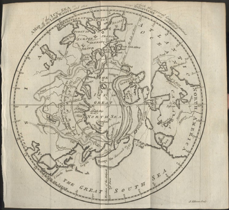
"A Map of the Icy Sea in which the Several Communications with the Land Waters and other New Discoveries are Exhibited"
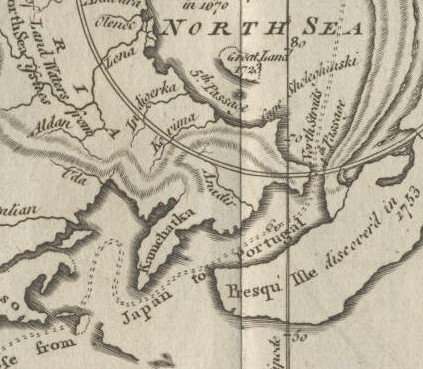
A map of the North Pole clearly shows a Northwest passage and a large Western Sea is depicted. Recent discoveries are shown as a bulging Alaska ("Presqu' Isle discoverd 1753") and a fictitious route from Japan to Portugal is also indicated. The close-up below shows the Pacific Ocean between Alaska and Russia and a sea route to Japan which originates on the map in Portugal.
Date: 1760 Price: SOLD
|