| Antique Prints | Autographs | Rare Books | Connecticut | Law |
| Maps | Miscellaneous | Newspapers & Magazines | Historical Memorabilia | Political |
| World War I Posters | World War II Posters |

|
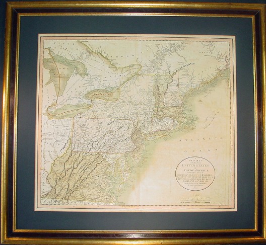
"A New Map of Part of the United States of North America, Containing those of New York, Vermont, New Hampshire, Massachusetts, Connecticut, Rhode Island, Pennsylvania, New Jersey, Delaware, Maryland and Virginia" Finely Detailed John Cary Map of Northeast America Published 1811-12 With Many State Borders Still Unresolved
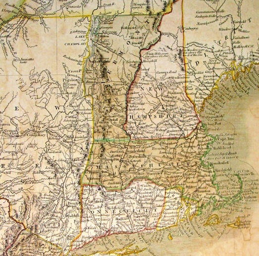
This wonderful historic map by John Cary was published in 1811-12 and its size within the borders is 18 x 20½ inches [HxW]. It has the original wash colors with minor offsetting from its days inside the Universal Atlas. It is nicely matted and framed to a size of about 25 x 28 inches. Below shows New England portion of the map with the borders for all the states still unresolved
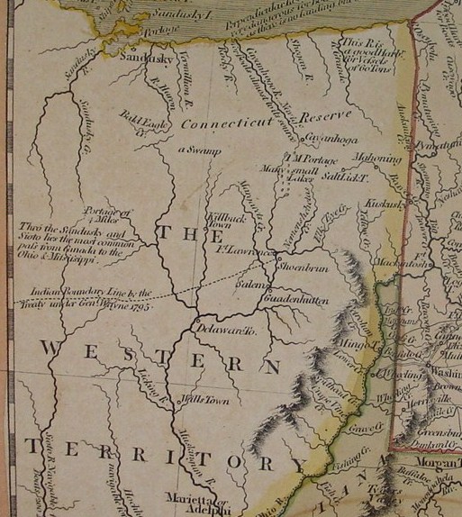
Below is the detail of the Western portion of the map, the current Ohio, labeled "Western Territory," with the Northern part still claimed by Connecticut as the "Connecticut Reserve" and a line marked "Indian Boundary Line by the Treaty Under Genl. Wayne 1795." It also notes the most common route from Canada to the Ohio and Mississippi Rivers via the Sandusky and Sioto river (with a 4 mile portage).
Price: SOLD
|