| Antique Prints | Autographs | Rare Books | Connecticut | Law |
| Maps | Miscellaneous | Newspapers & Magazines | Historical Memorabilia | Political |
| World War I Posters | World War II Posters |

|
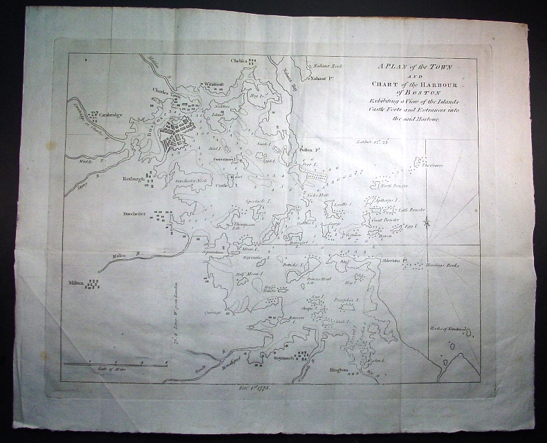
1775 "A Plan of the Town and Chart of the Harbour of Boston Exhibiting a View of the Islands Castle Forts and Entrances into the Said Harbour"
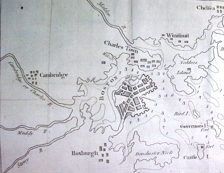
At the start of 1775 when British and American eyes were focused on Boston and the Boston Harbor as a result of the Port Closure Bill to be enforced by British troops the Gentleman's Magazine published this map. What followed in 1775 was the start of Revolutionary War conflict at Lexington and Concord and the first full pitched battle at Bunker Hill (in Charlestown as shown on this map). Below is the immediate area of the Town of Boston, from Chelsea to the North, Cambridge to the West and Roxburgh and Dorchester to the South.
Title: A Plan of the Town and Chart of the Harbour of Boston Exhibiting a View
of the Islands Castle Forts and Entrances into the Said Harbour Price: SOLD
|