| Antique Prints | Autographs | Rare Books | Connecticut | Law |
| Maps | Miscellaneous | Newspapers & Magazines | Historical Memorabilia | Political |
| World War I Posters | World War II Posters |

|
|
|
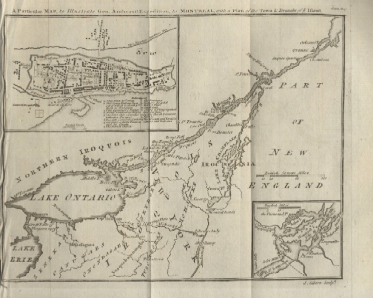
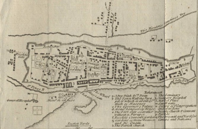
"A Particular Map, to Illustrate Gen. Amherst's, Expedition, to Montreal; with a Plan of the Town & Draught of ye Island"
This map is three maps in one, with an overview of the Northeast theatre of war in 1760, largely from Lake Erie to Montreal, a view of the Montreal vicinity in the bottom right and a street level view of Montreal at the top right which is shown above. Date: 1760 Price: $175/SOLD Pay securely with credit card through PayPal by clicking the button below
|