| Antique Prints | Autographs | Rare Books | Connecticut | Law |
| Maps | Miscellaneous | Newspapers & Magazines | Historical Memorabilia | Political |
| World War I Posters | World War II Posters |

|
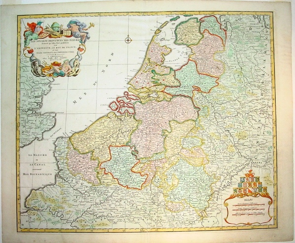
LES DIX-SEPT PROVINCE DES PAYS-BAS Jan Barend Elwe's 1792 Map of the European Low Country and Southeast England
This fine antique map of the European Low Country by Jan Barend Elwe entitled "Les dix-sept provinces des Pays-Bas" (The Seventeen Provinces of the Netherlands) was published in Amsterdam in 1792. It is about 20 x 23 inches (50 x 60 CM) (H x W) inside the borders. In addition to modern Netherlands, the map included all of Belgium and Luxembourg and portions of France (as far South as Rheims), Germany and Southeast England. The picture below shows the title cartouche and the mat fitted to the map border. I will take it out of the mat for shipping.
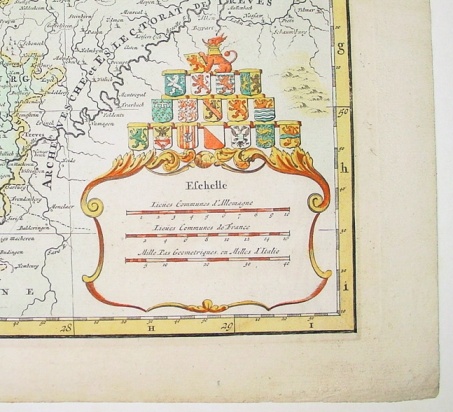
Below shows the legend cartouche on the bottom right corner with the coats of arms and the nice full margins on the map.
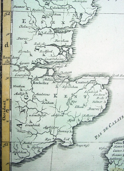
The picture below is of the left margin showing London inside the margin in the middle.
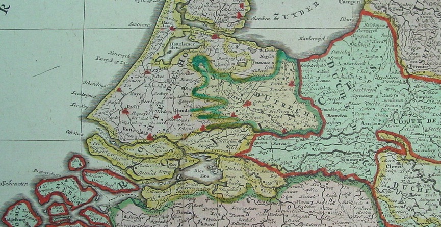
Below is a portion of the map showing Netherlands from Amsterdam and Leiden and the Hague to the Southwest.
My map software indicates that Jan Barend Elwe issued an Atlas in 1792 but there was no record of this map having been sold in the last few decades, so it is probably very rare. The world map in that atlas sold at last year at auction for over $3,000 and a number of other maps from that atlas sold for over $1,000. I did find one one uncolored example of our map on the internet located here: http://www.antiqbook.nl/boox/biss/_20262__.shtml which is offered for 650 Euros, about $1,025. Price: $850 (Insured Shipping will be $25 within the United States) Pay securely with credit card through PayPal by clicking the button below
|