| Antique Prints | Autographs | Rare Books | Connecticut | Law |
| Maps | Miscellaneous | Newspapers & Magazines | Historical Memorabilia | Political |
| World War I Posters | World War II Posters |

|
|
|
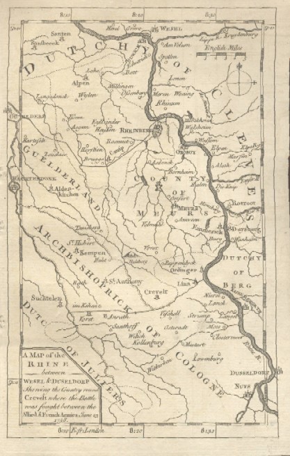
"A Map of the Rhine between Wesel & Duseldorp Shewing the Country round Crevelt Where the Battle Was Fought between the Allied & French Armies June 23, 1758"
Date: 1758 Price: $20 Pay securely with credit card through PayPal by clicking the button below
|