| Antique Prints | Autographs | Rare Books | Connecticut | Law |
| Maps | Miscellaneous | Newspapers & Magazines | Historical Memorabilia | Political |
| World War I Posters | World War II Posters |

|
|
|
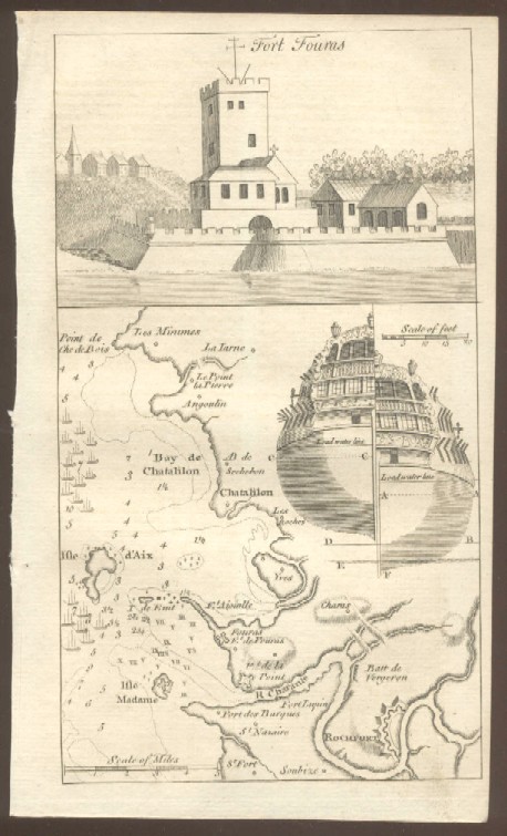
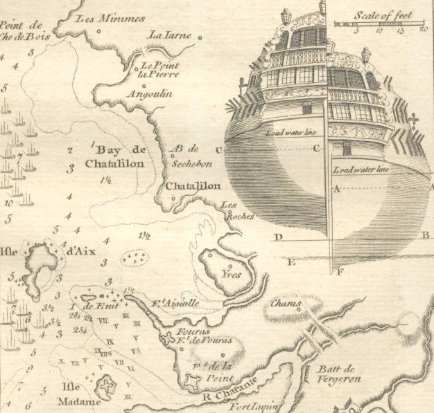
Fort Fouras and Coastal Vicinity
A copy of the text above will accompany the map. Date: 1758 Price: SOLD
|