| Antique Prints | Autographs | Rare Books | Connecticut | Law |
| Maps | Miscellaneous | Newspapers & Magazines | Historical Memorabilia | Political |
| World War I Posters | World War II Posters |

|
|
|
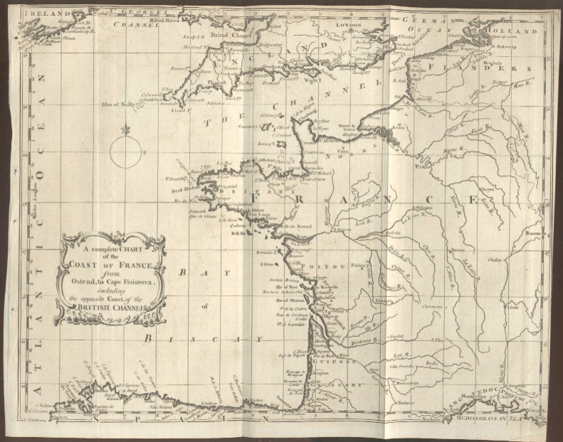
"A Complete Chart of the Coast of France. From Ostend, to Cape Finisterra, Including the Opposite Coast, of the British Channel."
This is a very nice antique copper engraved map at a very reasonable price. It shows Brittany, Normandy and the French coast south to Cape Finisterra, the northern coast of Spain along with towns, rivers and the cities of Paris, London, Antwerp and Marseilles. Date: 1758 Price: $60
|